|
Route Map
Lorient, France
Reykjavik, Iceland
Iqaluit, Nunavut, Canada
London, Ontario Canada
This trip took place in December 2006. In general, the weather
was fair and the greatest concern was the strength and direction of
the Polar jetstream. Refuelling took place at Reykjavik,
Iceland and Iqaluit, Nunavut, Canada. Iqaluit is located at
the Arctic Circle and is formerly known as Frobisher Bay, Northwest
Terriotories, Canada. Frobisher Bay was named for the English
navigator Martin Frobisher. Frobisher was the first European
to visit this land during his search for the Northwest Passage in
1576. The land is barren and unfriendly to the
uninitiated-brave men. |
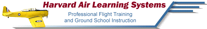
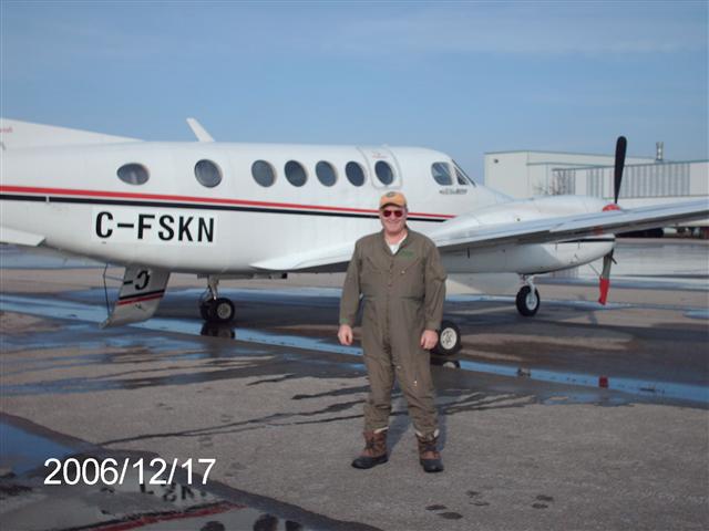
Beechcraft
Super King Air 200
This C-FSKN shown here at
Centralia (Huron Park) aerodrome, north of London, Ontario, Canada (CYCE).
This 1983 aircraft is in mint
condition. It is equipped with two Pratt & Whitney Canada
PT6A-42 turbo-props engines.
This aircraft is certified for up
to nine passengers with a range of about 1,500 nm. Used as a
corporate aircraft, it provides excellent dedicated and charter
service to its operator and passengers. |
Lorient, France
Lorient is located on the
northwest coast of France in the Brittany region, a most beautiful
area of the country and possesses a fascinating history.
L'Orient (French for orient) was
used by the French East India Company (founded in 1664) and was
chartered b y King Louis XIV. It developed as a spice trading
centre, major fishing port and a shipbuilding enterprise.
During World War II, Lorient was
reduced to ruins by Allied bombing. The Germans built U-Boat
pens in the harbour like they did in Brest to the north on the
coast. As the German wolfpacks preyed on Allied convoys,
Allied Command focused raids on cities like Lorient to eliminate the
support infrastructure of the German Navy U-Boat arm.
The U-Boat pens were so fortified
with concrete and steel that high explosive bombs would not
penetrate the structure. In the next thumbnail, I talk about
the U-Boat pen located in the Lorient Harbour. |
German Navy
U-Boat Pen Keroman
Lorient, France
Lorient was home for a
German
submarine
base during
World War II;
although the city was heavily damaged by Allied bombing raids, the
base survived through to the end of the war. As they could not
destroy the base itself, the Allies decided to bomb the city, in
order to cut supply lines to the
U-boats.
Without fuel, provisions or water, it became impossible for these
submarines to return to the Atlantic. Between the 14 Jan 1943 and17
February 1943, as many as 500 explosive bombs and more than 60,000
incendiary bombs
were dropped on the city. Lorient was almost completely destroyed,
with nearly 90% of the city flattened.
Today the former submarine base
of Keroman is open to the public and can be visited year-round.
During the tour the submarine pens of block K3 can be seen. The roof
area (3.40m to 7m thick) can be accessed, as well as a former anti
aircraft defence tower high on top of the base. The tower affords an
excellent view of the harbour and of the former headquarters of the
German Commander
Karl Dönitz
across the bay at Larmor-Plage.
|
|
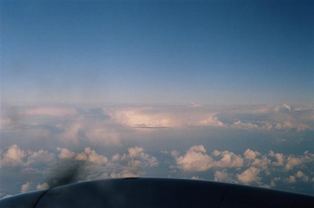
Jetstream
Effects
Scotland to Iceland
Halfway through the
first leg, we 'rounded the corner' at Stornaway, Hebrides
Islands, Scotland. The altitude was 28,000 feet (FL280) and
this was the 'jump-off' point to Iceland about 3 hours flight time
away.
As you can see from
the jetstream map where I have plotted our track line, rounding the
corner at Stornaway also meant a change in our track in and an
increasing headwind. The wind at FL280 was 74 knots and 'on
the nose'. The groundspeed took a real hit. The aircraft
was moving across the water at only 195 knots and it was cold at
altitude (-44°C).
As I looked down to
the brutally cold North Atlantic Ocean seeing white caps on the
rollers from 28,000 feet, I thought of the potential of surviving a
ditching-but only for a fleeting moment. Press on regardless.
Having had this
brilliant opportunity to fly this aircraft across the North Atlantic
route, I could not help but feel that it was one of those
moments in your lifetime that you will never forget. Moreover,
I made think of the men and women of the Royal Canadian Navy and
Royal Navy who sailed these waters during World War II on behalf of
our country's freedom. They had a bloody tough job indeed.
Well done! |
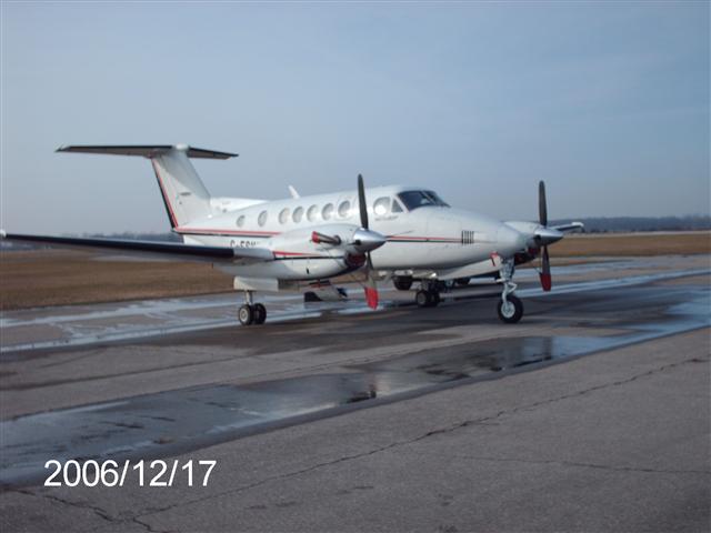
Ocean Current
Effects in the North Atlantic Ocean
Convective cloud activity dotted
the surface weather below 15,000 feet. In such cold weather,
it made me think of where the necessary heat was coming from to
generate the lift in these clouds.
This picture was taken from the
co-pilot's side looking to the northeast towards the Norweigan Sea.
I looked at an Ocean Currents map to determine the heat source and
found that the Gulf Stream flows up into the Norweigan Sea.
This answered my question. The Gulf Stream acts as a huge heat
transfer mechanism in the atmosphere. |
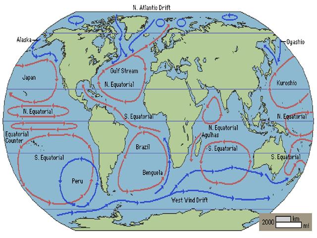
North Atlantic
Ocean Currents Map
This ocean
currents map shows how the Gulf Stream transports heat in to the
North Atlantic Ocean and Norweigan Sea.
|
South Coast of
Iceland
This is my first sighting of
Iceland as we approached the land mass at 28,000 feet.
It is really a spectacular island
and I was fortunate to have had the opportunity to see it
especially given the time of year we were transiting the North
Atlantic Ocean. |
|
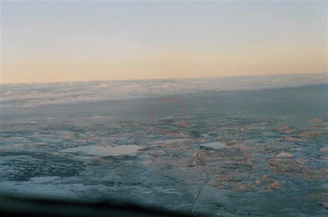
Geo-Thermal
Steam Vents Iceland
The circled areas are are
geothermal steam vents. Ground water seeps into the lower
volcanic rock structures where it is heated to above 100°C,
creating steam. It rises to the surface where is vents to the
atmosphere.
This picture was
taken southwest of Reykjavik near the popular "Blue Lagoon", a
volcanically heated mineral pool popular with Icelanders and
tourists. |
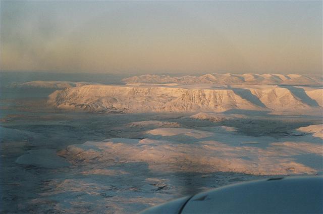
Approaching
Reykjavik in the descent from 28,000 ft.
The land mass forms demonstrate
the volcanic forms on the horizon. |
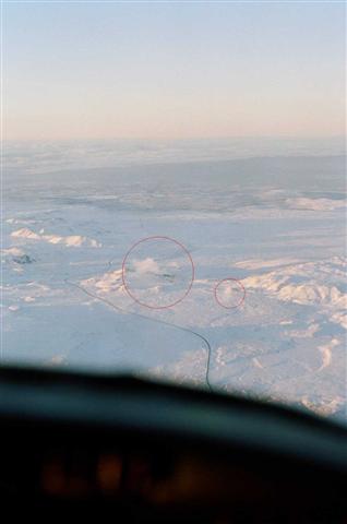
Approaching
Reykjavik
The
circle shows the airport complex. |
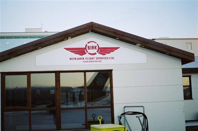
Reykjavik,
Iceland FBO
We refuelled the B200 King Air and
provisioned some food for the next leg to Iqaluit, Nunavut, Canada.
Iqualuit is the Innu name for the community formerly known as
Frobisher Bay. Frobisher Bay was named after Martin Frobisher,
a British explorer.
The next flight leg was completed
in the darkness of night to Iqaluit. Goose Bay was considered
however the winds were forecasted to be 'on the nose' which would
have resulted in a slow groundspeed and extended fuel burn.
Going to Goose Bay would have meant swimming. Iqaluit seemed
like the warmer option. |
|
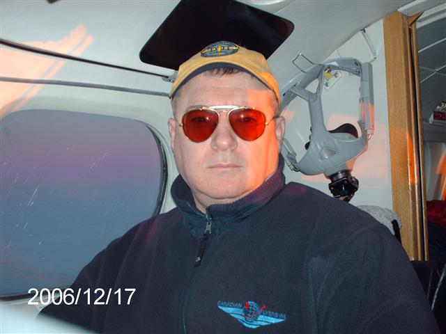
Early Departure
Iqaluit, Nunavut, Canada
After a whirlwind flight to Paris
and then Brittany and then to Iceland and Iqaluit, the next morning
was starting to show.
It was 'wheels up' at 07:30 out of
Iqaluit en route to London, Ontario, Canada. By the way, that
is not a mortar board I am wearing, it is a sun visor. |
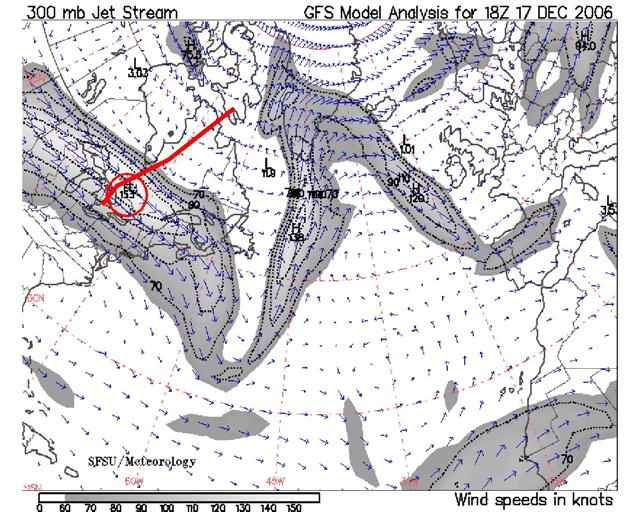
Iqaluit (CYFB)
Airport to Centralia (CYCE)
London, Ontario, Canada
As you can see from this jetstream
map, we encountered headwinds up to 153 knots.
Our groundspeed went from 265
knots down to 187 knots groundspeed. |
Centralia
Airport (CYCE)
London, Ontario, Canada
This picture was taken on 17 Dec
2006. Two weeks before this there as two feet of snow.
The temperature this day was about 15°
Celsius-very peculiar weather indeed. |
|